I keep my preparation together
I keep the route, weather, tides and practical notes beside the passage I intend to make.
 Connected Sailing
01 / Before we go
My passage plan, from the first idea to leaving the berth.
See how it helps ↓
How it helps me aboard Jocelyn
I keep the route, weather, tides and practical notes beside the passage I intend to make.
Before I start, the final review reminds me of the checks I want to confirm.
The work I do at home stays available on the iPad when I leave the berth.
On the Mac, I can bring a route together with destination information, radio contacts, marine notices and my own notes. Instead of remembering which window held which detail, I build a passage pack around the journey.
I review what goes into the pack, remove what I do not need and send it to Connected Sailing on the iPad and iPhone. The iPad is my main working screen aboard: an approved calendar journey becomes part of the passage plan, complete with its timed map, ready to use during the passage.
The plan is also where I choose whether to use the paper log and paired-device backup. If I already have a printed plan in my folder, I can keep that and print just the working entries underway.
Planning does not end when I leave the berth. I can return to the same journey during the passage and compare it with what is actually happening. That continuity is one of the things I most wanted.
Selecting a Passage Awareness Pack with a usable route now brings in suggested forecast areas along it. I can review and download the supported UK, Dutch and Belgian forecasts before leaving, including areas ahead of Jocelyn. This is useful for a North Sea crossing: my departure coast, the shipping area and the arrival coast are together, rather than only the area nearest home. A route-less Day Sailing pack keeps the usual UK weather.
I can use the four-tab weather map directly on the iPad or iPhone while preparing my passage. I place Jocelyn at a position, choose a speed through the water and heading, then explore the available forecast times. The nearest available valid tidal-stream point is applied automatically, with its distance shown and a manual override available. Illustrative mainsail and foresail shapes, plus an on-map point-of-sail label, help me see how apparent wind could change the sailing angle. I still make the judgement about the passage, source coverage and the boat.
My setup on screen
I read the written plan, its timings and checks—not just the setup controls. These current Connected Sailing screens use demonstration text and settings.
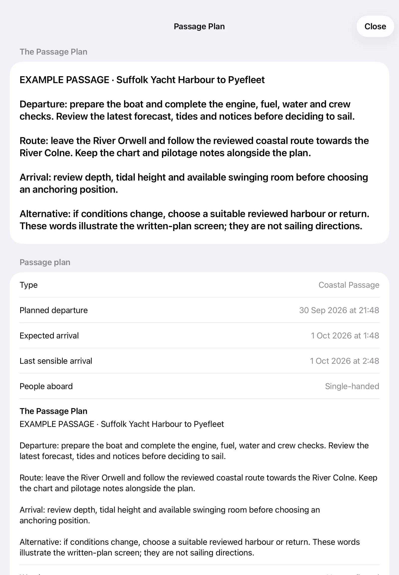
The written plan stays readable aboard, with departure checks, the route, arrival considerations and an alternative. This example text demonstrates the current screen and is not a set of sailing directions.
Enlarge screenshot ↗
The plan retains its departure, expected arrival, last sensible arrival and preparation checks. This demonstration deliberately leaves checks unconfirmed: displaying a plan is different from the skipper confirming readiness.
Enlarge screenshot ↗
The reviewed pack stays attached to the passage plan, with its build date and outstanding checks visible. Actual Connected Sailing controls using invented test content.
Enlarge screenshot ↗
I choose the working paper log and paired-phone recovery while preparing the passage. Demonstration screen from Connected Sailing; the unpaired and recovery-off messages show setup still to complete.
Enlarge screenshot ↗It connects with…